OUR SERVICES
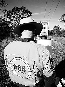
We are a small company offering Specialised Surveying Services.
We service Sydney, Central Coast, Newcastle and Hunter Regions.
For larger scale projects any location is possible.
Unsure of the type of survey you need?
Contact us and we can help.


01
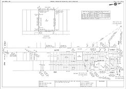
DETAIL SURVEYS
This survey can have many end user purposes, but it ultimately is used to determine the lay of the land. A detail survey involves measurements over the parcel of land to determine levels or heights in relation to a specified base height. This can be an arbitrary height for the parcel or it can be related to the Australian Height Datum (AHD). The plan can also be placed onto the Map Grid of Australia (MGA) which is an Australian based coordinate system.
A detail survey will result in plan supplied to the client/architect/engineer showing the boundaries of the subject parcel and any significant features such as buildings and structures, concrete areas, adjoining buildings, significant trees and any visible services. Specific requirements from different designers can also be accommodated.
02
BOUNDARY PEGGING
Sometimes, the owner of a parcel of land decides that they would like to replace the existing fences. To ensure there is no dispute with neighbours it is recommended to have this type of survey undertaken. A boundary pegging is just that, the surveyor attends the site, determines where the boundaries of the parcel are, and places timber pegs in the ground at the corners. Pegs may also be placed at specific distances from the boundaries so that as post holes are dug the location of the boundary can still be determined without the need for a further visit from the surveyor.
03
IDENTIFICATION SURVEY
In some cases, when purchasing a new house the lending body for finances may request that you have an Identification Survey completed. This survey identifies the parcel of land; looks at the title to see if there are any easements or encumbrances over the land; determines if there are any encroachments by or on the parcel of land; and locates the existing residence on the site. In some cases, the lending party may request that they be notified of any structures that have not been approved by council over the land.
04
REDEFINITIONS
A Redefinition Survey is primarily used so that a client has a new plan of survey showing the land that they own. Due to changes in regulations in recent years any new strata plan is required to have a recent plan of survey registered with the New South Wales Land Registry Service which is then to be used as a base plan. The plan of survey could be a subdivision of several lots into individual lots, a consolidation of several lots into one lot or even a consolidation of several strata plans into one plan.
05
SUBDIVISIONS
A subdivision is the separation of one parcel of land into several. A subdivision can also be classified as the amendment of the boundaries between two or more parcels of land to allow larger or smaller parcels within the existing framework. This type of subdivision is sometimes called a boundary re-alignment. Subdivisions also sometimes include the division of two townhouses into separate lots joined by a common or ‘party’ wall.
06
CONSOLIDATIONS
A consolidation is the joining of parcels of land. If you are the owner of two or more parcels of land and you wish to develop them to allow construction, then a consolidation survey may be required. Due to changes in regulations, a plan of survey is required before undertaking a strata subdivision. You may also wish to join the parcels of land for the simple fact that the original survey showed your land as being very narrow strips of land. These parcels of land were then sold in groups of two or three and a house was constructed over many of the lots. A consolidation will reduce the number of parcels that you have, which may make it easier to sell in the future. In many cases, this can be completed at the same time as a Redefinition plan.
07
EASEMENT SURVEYS
At various times, an easement (a right to a parcel of land) is required to be created. An easement can be for many purposes including allowing someone access to a parcel of land, protecting an asset such as a substation or to allow someone to drain water through someone else’s land. Easements are created during the completion of another type of survey but cannot be created when completing detail surveys, boundary pegging and identification surveys. If required during a redefinition survey, it will then be named a plan of redefinition and creation of easement. Easements can also be created separately to any other types of surveys via a transfer and grant.
08
STRATA SUBDIVISION PLANS
This type of plan is for the subdivision of units for residential purposes into separate titles within a large or small complex. Each parcel of land, or unit, then has certain rights for voting on changes, but they are also required to have certain restrictions and entitlements placed on them. Strata subdivision also comes with a strata management scheme. We work with solicitors to ensure the unit entitlements are included in the scheme. Strata plans can be completed at the start of a project, from architectural plans, and can be used for sales and marketing. These are generally in the form of a draft strata plan. Once the construction has been completed a full survey of each unit is undertaken so that areas can be calculated correctly. A strata plan can also allocate parking spaces to each unit, as well as storage spaces and common property.
09
STRATUM SUBDIVISION PLANS
This type of plan is like a strata subdivision plan but is generally used for commercial purposes or mixed-use developments within a larger complex. The larger complex can be on the one level or it can be multi storey. Additional restrictions are placed on the lower levels of the development, usually the commercial portion, which will only allow them access to a designated height within the overall development. Separate storage areas that can only be accessed by the commercial portion can also be allocated. Stratum can also be used for services within the building such as telephone, water, sewer and gas.
fyi
did you know?
Redefinition, subdivision, consolidation, easement, strata and stratum surveys all result in a plan of survey being registered with the New South Wales Land Registry Service (NSW LRS) in accordance with the associated Acts and Regulations. Other associated documents for the plans will also be registered with them.